Harnessing Digital Solutions for Sustainable Housing Expansion: A GIS-Powered Approach
By Richard Kingston | Originally published by Policy@Manchester
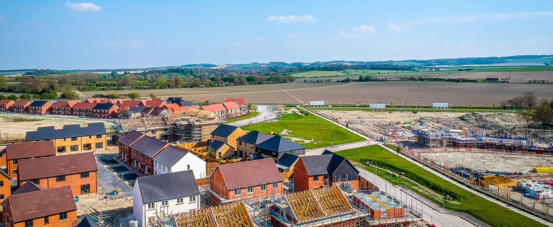
The UK government has committed to an ambitious housing strategy of building 1.5 million homes over the next five years to address the chronic housing shortage exacerbated by rising demand, affordability and population growth. This plan must also rectify long-term structural challenges in the housing market whilst ensuring homes are built sustainably. Here, Professor Richard Kingston outlines how the Digital Solutions Hub can offer cutting-edge solutions to these problems, providing policymakers with the tools to make evidence-based decisions on where, how, and when to build.
- Britain’s current housing crisis and the long-term structural challenges of the housing market are set to be addressed by the government’s 1.5 million new homes target.
- Policymakers must ensure that these new developments balance multiple factors – land suitability and environmental considerations, infrastructure and connectivity, and decarbonisation and climate adaptation.
- The Digital Solutions Hub, a free online mapping toolkit launching in 2025, allows easy-to-access environmental, social, economic and health data to inform policymakers’ decisions, to ensure new houses provide long-term multi-faceted benefits.
1.5 million homes
Over the next parliament, the UK government has committed to building 1.5 million homes. This plan seeks to not only address immediate housing needs but also rectify long-term structural challenges in the housing market.
While the policy’s aims are clear, several challenges remain. Identifying appropriate land for housing requires balancing multiple factors—availability, environmental protection, and infrastructure capabilities. Ensuring access to reliable transport networks, utilities, and public services is critical for creating not just houses but thriving communities. Simultaneously, new housing projects must address climate concerns, minimise carbon footprints and adapt to risks like flooding or biodiversity loss.
Spatial data, environmental monitoring, and Geographic Information Systems (GIS) can offer cutting-edge solutions to these problems, providing policymakers with tools to make evidence-based decisions on where, how, and when to build. This is where the NERC-funded Digital Solutions Hub (DSH) plays a transformative role. With access to a wealth of environmental data, and the ability to model and visualise complex spatial relationships, the Hub empowers local authorities, planners, and developers to better align housing expansion with environmental, social, and economic goals.
Harnessing Spatial Data and GIS for Strategic Housing Development
At the heart of the DSH is the capability to gather, analyse, and visualise spatial data. GIS tools, combined with real-time environmental monitoring, offer policymakers insights into the interaction between proposed housing developments and the natural landscape. This can help ensure that housing strategies are underpinned by comprehensive environmental and spatial analysis, leading to more sustainable and efficient outcomes. By integrating future climate change models, policymakers can also assess what developments might look like in 2050, 2060 or even 2070.
Land Suitability and Environmental Considerations
One of the key challenges in housing development is identifying suitable land that supports large-scale construction while mitigating environmental impacts. Through the use of spatial data, the DSH provides detailed information about land use patterns, soil quality, water resources, flood risks, and biodiversity hotspots. This allows planners to avoid ecologically sensitive areas and prioritise locations where environmental disruption can be minimised.
For example, the Hub can generate flood risk maps based on historic data and climate projections, enabling policymakers to assess the long-term viability of a site before breaking ground.
Infrastructure and Connectivity
Housing developments cannot exist in isolation. They require seamless integration with transportation networks, public utilities, schools, hospitals, and other essential services. GIS-based models, supported by the DSH, provide a clear picture of existing infrastructure and highlight gaps or pressure points that new developments would create.
Using spatial data, planners can map proximity to transport hubs, roads, and green spaces, identifying areas where housing could reinforce local economies and improve social mobility. For instance, planners might focus on sites that have access to public transport, reducing car dependency and contributing to emissions reductions, ensuring that new housing developments are not only liveable but also sustainable and connected to broader urban and regional networks.
Supporting Decarbonisation and Climate Adaptation
Climate resilience is becoming an increasingly important consideration, as extreme weather events, rising sea levels, and higher temperatures threaten the viability of housing in certain areas. We have already developed the Climate Just mapping tool to understand some of these impacts on different communities at the neighbourhood scale.
GIS technology enables planners to assess the climate risks associated with specific sites and to explore opportunities for integrating renewable energy sources, such as wind, solar and thermal power, into housing projects. The DSH supports this by providing detailed environmental data and models to analyse how different developments interact with energy demand, emissions outputs, and natural carbon sinks like forests or wetlands.
In this way, the Hub facilitates climate-smart planning, ensuring that new homes are built in locations that not only avoid high-risk zones but also contribute positively to the UK’s net-zero aspirations.
Policy Recommendations for Sustainable Housing Development
As policymakers grapple with the challenge of building 1.5 million homes, they must consider a multi-faceted approach that prioritises sustainability, infrastructure resilience, and climate adaptation. These can be addressed in part by decision makers following four criteria:
1. Prioritising Land-Use Efficiency through Data-Driven Site Selection
One of the most immediate applications of spatial data is the identification of optimal sites for housing development. Policymakers should work closely with local authorities, developers and researchers to utilise GIS tools – like the DSH – in selecting sites that balance housing needs with environmental protection. Areas with low biodiversity impact, minimal flood risk, and existing infrastructure connectivity should be prioritised, while ecologically sensitive regions should be avoided.
2. Aligning Housing Projects with Infrastructure Planning
Housing development should not be seen in isolation from broader infrastructure needs. Policymakers should mandate that new developments are integrated with existing or planned transport networks, utilities, and public services. Using the data from the DSH, planners can better anticipate where infrastructure upgrades are needed and coordinate housing projects accordingly. This will ensure that new developments are not only liveable but contribute to the economic vitality of surrounding areas.
3. Incorporating Climate Resilience into Housing Policies
As the UK moves towards its 2050 net-zero target, housing development must be aligned with climate goals. Spatial data can help identify areas where renewable energy can be incorporated into housing projects, whether through on-site energy generation or access to regional renewable grids. Policymakers should develop guidelines that require housing developers to assess and integrate climate resilience measures into their planning, ensuring homes are built to withstand future climate risks while contributing to carbon reduction targets.
4. Promoting Cross-Sector Collaboration
The success of any housing strategy depends on coordination between government bodies, environmental groups, local communities and the private sector. The DSH is a critical platform for facilitating collaboration between these stakeholders, allowing them to share data, insights, and best practice. Policymakers should encourage ongoing collaboration, creating cross-sectoral partnerships that leverage spatial data to achieve housing targets in a way that is socially, economically, and environmentally sustainable.
The government has a unique opportunity to address the housing crisis while also advancing broader sustainability and climate resilience goals. By leveraging the capability of spatial data and GIS tools, policymakers can ensure new developments are well-placed, well-connected and climate ready. Insights made available through the DSH, can play a pivotal role in ensuring that housing targets are met in a way that balances economic growth with environmental stewardship.